Samsun became a metropolitan city in 2008. It has 17 districts, four of which are central districts, while the remaining 13 are outer districts. Central districts: Tekkeköy, Canik, İlkadım, and Atakum. Since the monuments in the central districts are covered in the provincial section, only the outer districts will be discussed.
Alaçam
The city was named Alaçam by the Ilkhanids in the 14th century. Its borders are as follows: the Black Sea to the north, Bafra to the east, Vezirköprü to the south, and Sinop to the west. It became a district in 1944.
HISTORICAL MONUMENTS
Dedetepe Archaeological Site – The location of Hüseyin Dede's Tomb, near Yenice Village.
Ali Osman Tepe Archaeological Site – Near Gökçeboğaz Village.
Sadi Bey Mosque – 16th century.
Çarşı Mosque – 19th century.
Historical Greek Mansions
Sivritepe Archaeological Site
Geyikbaba Tomb – The exact time of Geyikbaba's life is unknown. According to legend, a farmer lived in the region and plowed his field with deer harnessed to a golden yoke, using a plow made of gold. One day, a group of travelers frightened the deer, which fled to Meydancık Mountain and never returned. After Geyikbaba passed away, the people built a tomb in his honor. According to tradition, Abu Ayyub al-Ansari is said to have visited this tomb (!). Every year, the Hıdrellez Festival is celebrated here.
TOURIST ATTRACTIONS & FESTIVALS
Geyikkoşan Picnic Area – A forested area covered with plane trees, laurel, and poplars, with part of it along the seaside.
Geyikkoşan Beach Area – Suitable for caravan and tent camping, with designated bicycle and walking trails. Wrestling arena facilities are also being developed.
Alaçam Population Exchange Museum
Traditional Keşkek Day at Sivritepe
Alaçam Teachers' Lodge – Located by Geyikkoşan beaches, serving as an accommodation facility.
Asarcık
It is surrounded by Samsun to the north, Çarşamba and Ayvacık to the east, Amasya to the south, and Lâdik and Kavak to the west.
HISTORICAL MONUMENTS
Horoztepe Tumuli
Gölköy Mosque in Akalan Village – 13th century
Gökgöl Water Mill – Still operational
Koşaca Wooden Mosque – Exact construction date unknown; renovated in the 18th century
TOURIST ATTRACTIONS & FESTIVALS
Yarımca Village Picnic Area
September Horse Racing Festival
Wrestling Festival at Töngel Tepe
Ayvacık
It is surrounded by Çarşamba to the north, Salıpazarı and Ordu to the east, Tokat and Amasya to the south.
Historical Monument: Church Ruins in Akalan
TOURIST ATTRACTIONS
Hasan Uğurlu Dam Hydroelectric Power Plant – Fishing opportunities in the dam, where catfish, mullet, and carp are commonly caught.
Suat Uğurlu Dam Lake – Picnic areas, cafes, and seafood restaurants; ferry leisure tours and canoeing activities on the lake.
Ayvacık Waterfall
TRADITIONAL HANDICRAFT
Cicim – A finely woven embroidered kilim.
Bafra
The name Bafra originates from the word "bafira", meaning "home". Bafra is surrounded by the Black Sea to the north, 19 Mayıs and Samsun to the east, Kavak, Havza, and Vezirköprü to the south, and Alaçam to the west.
HISTORICAL MONUMENTS
İkiztepe Archaeological Site
Excavations were carried out by German archaeologist Mallaart in 1969, Bahadır Alkım in 1974, and Önder Bilgi in 1981. The site remains under excavation today. Artifacts from the Chalcolithic and Bronze Ages, as well as the Hittite, Hellenistic, and Roman periods, have been unearthed. The largest burial chambers in Turkey were discovered in the İkiztepe Necropolis, and the findings are exhibited at the Samsun Archaeology Museum. Additionally, the Bafra Archaeology Museum is under construction.
Asarkale
Used by various states since the Hellenistic period, this fortress contained secret underground passages that allowed defenders to ambush enemies from behind.
Paphlagonian Rock Tombs of the Hellenistic Era
Located around the dam lake.
Tayyar Paşa Mosque
19th century
Bedestan (Covered Bazaar)
17th century
Emir Mirza Bey Mausoleum
Emir Mirza Bey was part of the İsfendiyar Dynasty. His mausoleum was built in the 14th century and restored in 1995.
Hızır Bey Mausoleum
The tomb of Hızır Bey, also from the İsfendiyar Dynasty, was built in the 15th century. It is visited by the sick seeking healing.
Ali Çetinkaya Bridge
Originally, there was a wooden bridge over the Kızılırmak River. In 1937, it was replaced with a stone bridge named after Ali Çetinkaya, the Minister of Transportation at the time. The bridge is 250 meters long and has seven arches. A local tradition: Newlywed brides walk across the bridge while people sing the folk song "Köprüden Geçti Gelin" (The Bride Passed Over the Bridge).
TOURIST ATTRACTIONS
Bafra Museum
Opened in 2011 as an Archaeology and Ethnography Museum in the historic Efraim Ağa Mansion. A new museum building is under construction.
Fishing Lakes
The lake region consists of 33 lakes. The largest is Çernek Lake, with other significant lakes including Dutdibi, Liman, Hayırlı, Uzungöl, Tombulgöl, and İncegöl. Catfish, bass, zander, and carp are commonly caught in these lakes. Crayfish from the lakes and snails collected from the area are exported to Western countries.
Additionally, the Subasar meadows and forests are part of the geological structure of the Kızılırmak Delta.
Kızılırmak Delta Bird Paradise
Home to an estimated 100,000 birds from 340 species. Birds can be observed from watchtowers, and footage of the area is accessible via remote viewing stations.
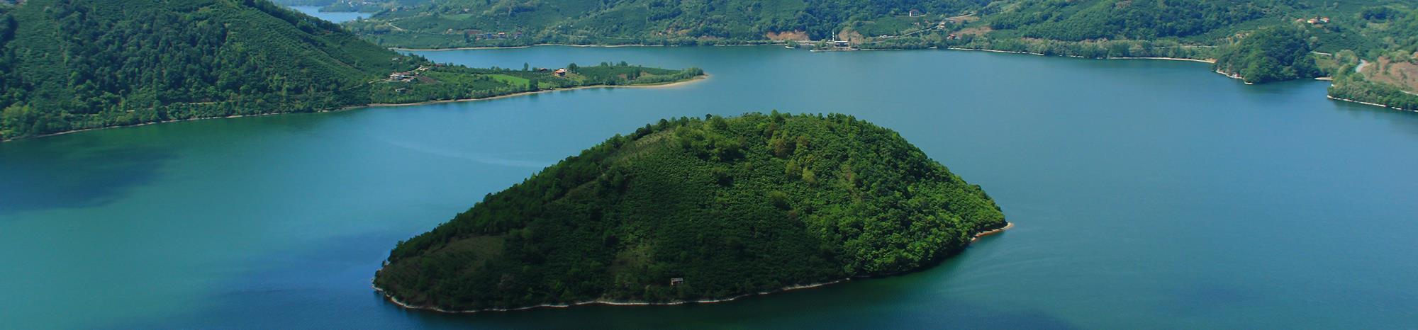
Altınkaya Dam Lake
Offers boat tours and fishing activities.
Derbent Dam
Located 35 km from Bafra, surrounded by picnic areas and fish restaurants. The minaret of a submerged village mosque creates a fascinating visual scene. Visitors can enjoy boating, surfing, and paragliding, as the area is well-suited for the sport.
Akalan Waterfall
Kolay Equestrian Tourism Center
Karaboğaz Pond
A picnic area close to the western shores of the Kızılırmak Delta.
Park and Fountain at Cumhuriyet Square
Sürmeli Village
Known for guesthouses, souvenir markets, and eco-tourism development.
IMPORTANT INSTITUTIONS
Sevgi Hotel – Privately certified tourist hotel
Çelik Park Shopping Mall & Bafra Premier Cinema
Bafra TV
Gökkuşağı Trout Production Facilities (Located at Derbent Dam Lake)
SCHOOLS
Bafra Vocational School
Private Bafra College
FESTIVALS IN BAFRA
Bafra Watermelon Festival
Held during the last week of August.
Sele-Sepet Festival
Celebrated on the 15th day of Ramadan. In the evening, children roam the houses with lanterns and receive various gifts.
Hıdrellez Festival
Observed on May 6, marking the arrival of spring. People gather for a communal picnic, believing that wishes made on this day will be granted.
Neyzen Tevfik Cultural Festival
Held in the last week of August, featuring poetry readings, music performances, and traditional folk dances.
Çarşamba
HISTORICAL MONUMENTS
Tepecik Archaeological Site
Kilisetepe Archaeological Site
Ordu Village (on the Ayvacık road)
A 14th-century settlement of the Tacettin Dynasty. Legend states that Hüsamettin Hasan Bey arrived here with his two brothers and fought against the Byzantines, ultimately losing his life in battle. A mausoleum was built in his honor, where his sword is believed to be kept.
Bedestan (Covered Bazaar)
Built in the 19th century.
Rıdvan Bey Mosque
Built in the 18th century, restored at various times. Located on the east bank of the Yeşilırmak River.
Abdullah Paşa Mosque
Built in the 19th century, located on the west bank of the Yeşilırmak River.
Değirmenbaşı Mosque
Built in 1908, the neighborhood it stands in was named after it.
Kanarya Mosque
A mosque from the Republican era.
Şeyh Habil Mosque
Built in the 17th century, located in Helvacalı.
Göyceli Wooden Mosque
The oldest mosque in the Central Black Sea Region, built in the 13th century. Located within a cemetery and constructed entirely of wood without using metal nails. It remains open for worship.
Aşağı Donurlu, Karagöz, Turgutlu,
and Zeyfelli Wooden Mosques
Çarşamba Bridge
Originally, a wooden bridge stood in its place, but during the early years of the Republic, it was replaced with a new structure. Today, the bridge is closed to vehicle traffic, allowing only pedestrians to cross. There are four bridges over the Yeşilırmak River in Çarşamba.
TOURIST ATTRACTIONS
Kestanepınar and Ulupınar Caves
Gelemen Hacı Osman Forests
Ordu Village – Facilities for hot air balloon rides, paragliding, and model airplane tracks are being developed.
Beaches west of Cıva Burnu – A 50 km-long sandy coastline, ideal for seaside camping. New facilities are being built.
IMPORTANT INSTITUTIONS & FACILITIES
Çarşamba Airport – Located in Çınarlı.
Mustafa Dağıstanlı Indoor Sports Hall
Vefa Shopping Mall & Primer Cinema
SCHOOLS
Çarşamba Vocational School
Çarşamba Cultural College
IMPORTANT DAY
May 20 – Culture and Arts Festival
Havza
Origin of the Name Havza, it is said that the name of the town Havza originates from the Hittite-era governor "Khavuzhan". In historical sources, Havza is also referred to as "Ancere". In 1925, Havza was separated from Amasya province and became part of Samsun.
Borders of Havza Havza is surrounded by Bafra to the north, Kavak and Lâdik to the east, Amasya and Çorum to the south, and Vezirköprü to the west.
HISTORICAL MONUMENTS
1. Lerdüge Archaeological Site: Located near Çamyatağı Village, this site was excavated by Uğur Bahadır Alkım in 1972, and the findings were exhibited in the Samsun Archaeology Museum. Excavations later continued at the site. Reliefs measuring 16 x 35 cm have been discovered, depicting ivy, deer fawns, peacocks, horned goats, and centaurs (human-headed horses). Artifacts sent to the Ankara Hittite Archaeology Museum include a gold ring, gold jewelry, a cremation urn (holding the ashes of a burned deceased), a bronze oil lamp, bronze chains, hinges, lead plaques, a red jug, and tear bottles.
2. King Rock Tombs of the Hellenistic Period in Şerifali Village
3. Havza Thermal Springs: Thermal springs are hot waters emerging from the Earth's layers close to the magma. According to legend, around 200 years ago, an earthquake caused underground waters to rise, flooding the entire town with hot water and resulting in a great disaster.
The temperature of the thermal waters is 55oC. Havza's thermal springs have been utilized during the Roman, Byzantine, Selçuk, and Ottoman periods and continue to be used today.
MAIN THERMAL SPRINGS
Aslanağzı Thermal Spring: Built in the 15th century, with a capacity of 100 people.
Kızgözü Thermal Spring: Constructed in the same period as Aslanağzı Thermal Spring and has the same capacity. According to legend, while three young women were bathing in the spring, raiders attacked and harassed them. The girls prayed to God, saying, "God, save us—turn us into birds or stone". Their prayers were accepted: two of the girls turned into birds and flew away, while one was turned into stone. It is believed that tears still flow from the eyes of the stone girl. There are 22 private bathing cabins next to the spring.
Şifa Thermal Spring: Built in the 15th century as an extension to Aslanağzı Thermal Spring.
Vakıf Bath: Built in the 13th century during the Seljuk period.
Maarif Bath: Constructed in the 19th century.
Lokman Hekim Thermal Springs: Built in 1986, these springs are considered modern Turkish baths.
Soup Kitchen: Built as an imaret (charitable kitchen) in the 15th century; later restored and used as a library between 1940-1982.
4. Yörgüç Mustafa Bey Complex: Also known as the Thermal Springs Mosque, this complex consists of a mosque, tomb, and imaret (a charitable kitchen providing meals to the poor).
5. Bin Bereket Shah Mosque and Tomb: Located in Dereköy, this mosque dates back to the 13th-century Seljuk period.
6. Sivrikese Mosque: Situated in Sivrikese Village, constructed in the 19th century.
7. Taş Mektep (Stone School): Built as a school in 1911.
8. Atatürk Museum: This three-story building was originally the Mesudiye Hotel, where Atatürk stayed between May 25 and June 13, 1919. It was later used by the fire department and opened as the Atatürk Museum in 1984.
The ground floor serves as an exhibition hall for handicrafts. The middle floor showcases Atatürk's personal belongings, documents, and commemorative photographs. The upper floor features four rooms dedicated to the Amasya Circular, Erzurum and Sivas Congresses, and the opening of the Turkish Grand National Assembly.
FESTIVAL DAYS
May 25 Atatürk Commemoration Festival: The arrival of Atatürk in Havza on May 25, 1919, is celebrated with enthusiasm. Until recently, every year on May 25, people from Samsun would travel to Havza by free train to participate in the celebrations. They would bring their own food and enjoy a picnic together. Unfortunately, this tradition has been abandoned in recent years.
EDUCATIONAL INSTITUTIONS IN HAVZA
Havza Vocational School (Established in 1993)
Kavak
The district gets its name from the poplar tree. Its borders: To the north, Bafra and Samsun; to the east, Asarcık; to the south, Lâdik; and to the west, Havza.
HISTORICAL MONUMENTS
Kaledoruğu archaeological site
Çakallı Bridge
Çakallı Wooden Mosque (19th century)
Bekdemir Village Wooden Mosque (19th century)
Çakallı Inn: A 13th-century Seljuk-era structure. Inns were places where travelers on foot, horseback, or camel could stay. The Çakallı Inn was restored in 2011 and now serves as a restaurant. Çakallı Menemen is a famous dish in the Samsun region.
KAVAK'S WATERFALLS
Küçük Çukur Waterfall
Gürgüt Waterfall
Ortaköy Waterfall
FESTIVALS
September 9th Yaşar Doğu Festival
Keşik Festival: "Keşik" means "turn" or "order". According to old Turkish traditions, each family in the village would take turns hosting meals three times a day for all the villagers. The next day, another family would take over. This tradition has faded over time.
SCHOOLS
Kavak Vocational School
Lâdik
The name Lâdik comes from "Laodika", the wife of Pontic Greek King Mithridates V. Borders: To the north, Kavak and Asarcık; to the east and south, Amasya; and to the west, Havza. Lâdik was transferred from Amasya to Samsun in 1925.
HISTORICAL MONUMENTS
Dökme Tepe Tumulus
Located near Alanyurt Village.
Tombul Tepe Tumulus
Situated in Hamit Village.
Seyit Ahmet Kebir Tomb
A 13th-century Seljuk-era structure surrounded by several religious lodges.
Bülbül Hatun Mosque
Built in the 15th century by Bülbül Hatun, the wife of Sultan Bayezid II.
Avcı Sultan Mehmet Mosque
The first mosque was built in the 17th century by Sultan Mehmed IV; later, a new structure replaced it.
Sunullah Pasha Tomb
Constructed in the 16th century.
Clock Tower
The first clock tower was built in 1889. After the original collapsed in the 1943 earthquake, a new tower was constructed. Its clock was sent from Samsun Tower in 1977.
PLACES TO VISIT
Ambarköy Open-Air Museum
This open-air museum resembles a typical 18th-century Ottoman village. The barns and houses have been built authentically with wooden materials, just like in the past. The village mosque is also made of wood. The museum serves multiple purposes, and new facilities continue to be added.
Lâdik Lake
Lâdik Lake is the source of the Tersakan Stream. The area surrounding the lake serves as a picnic spot, and trout and pike fish can be caught here. The reeds from the lake are used for weaving mats. The lake is located 10 km from Lâdik. Many bird species can be observed in the Lâdik Lake Bird Paradise.
Akdağ Mountain
At 2,062 meters, Akdağ Mountain hosts various activities:
Akdağ Safari Route: Tours are organized for those interested in wildlife hunting.
Paragliding: The sport of paragliding has become increasingly popular in recent years. Other aviation activities, such as gliding, have also started.
Akdağ Ski Center: Ski slopes have been arranged for winter sports, and chairlifts have been installed.
Hamamayağı Thermal Springs
Located 10 km away, the area offers accommodation facilities.
Büyükkızoğlu Waterfall and Waterfall Lake
Fishing is possible in the Büyükkızoğlu Waterfall and its adjacent Waterfall Lake.
FESTIVALS
Küpecik Plateau Festival – Held in the summer, 23 km away from Lâdik.
Ondokuz Mayıs
When Ballıca district became a county, its name was changed, and the date of Atatürk's arrival in Samsun was given as the county's name. Boundaries: It is surrounded by the Black Sea to the east and north, Bafra to the west, and Samsun to the south and southeast.
HISTORICAL MONUMENTS
Yörükler Town Tumulus and historical bath
Beylik Village Ruins
Kefteroğlu Tumulus in Çetinlipınar Village
Wooden Mosque: 19th century
Stone Bridge: Built in the 19th century, with a single arch
Saathane Square
TOURIST ATTRACTIONS
Nebiyan Plateau: a forested picnic area
Engiz Sea Camp: caravan sites and motels
Fishing at Balıklı lakes
Wooden pier and a slide for children
Facilities and Institutions
Dereköy Fishing Port
Ballıca Cigarette Factory (1997)
SCHOOLS
19 May Civil Aviation Vocational School: A vocational school affiliated with O.M.Ü.
FESTIVALS
Hüseyin Dede Festival (May 7)
Salıpazarı
The district's name originates from the fact that a market was set up here on Tuesdays. The district center was formed by the merging of Alanyakın, Düzköy, and Bereket villages. Boundaries: It is surrounded by Çarşamba to the north, Ordu to the east, Tokat to the south, and Ayvacık to the west.
HISTORICAL MONUMENTS
Garpu Castle
Also known as "Amazon Castle." The date of its initial construction is unknown. Around the castle, there are rock tombs from the Hellenistic period.
Historic Mill
Said to have been built in the 16th century. It is still in operation.
Yeşilköy Wooden Mosque and Yeşil Tomb
Estimated to have been built in the 17th century.
Hasan Tekke
Located on a high hill. It is rumored to belong to a soldier who was martyred during the War of Independence. Another legend states that during the 1974 Cyprus War, a red light emerged from the tekke and traveled to Cyprus.
Eğri Castle
Located in Kırgıl Village. Its construction date is unknown. Some believe it was built by God during the time of Prophet Noah to anchor ships.
Karacaören Village Wooden Houses
TOURIST ATTRACTIONS
Karacaören Waterfall
Yayla Village Forest Rhododendrons
Çağlayan Village Waterfalls
Kınalık Forest Picnic Area
Terme
The name "Terme" comes from the historical name of the Terme River, "Thermedon". It is bordered by the Black Sea to the north, Ordu to the east, Salıpazarı to the south, and Çarşamba to the west.
HISTORICAL MONUMENTS
Themiskyra Ancient City
Located in Gölyazı Village. According to mythological stories, Amazon warrior women established a tent city here.
Sarayköy Aqueducts and Bath Ruins
Pazar Mosque
19th century
Y. Söğütlü Wooden Mosque
13th century
Söğütlü Wooden Mosque
The construction date is unknown, but it was repaired in the 19th century. The mosque has two floors.
Cüneyt Bey Tomb
14th century. Belongs to Kubadoğlu Cüneyt Bey, located in Dibekli Village. According to legend, Cüneyt Bey lost his arm in battle. When he died, his arm was placed in his tomb. However, it did not remain there—it returned to its original place on its own.
Karacali Village Wooden Mosque
14th century
TOURIST ATTRACTIONS
Miliç Pine Grove: A picnic area, beach, and campsite. New facilities are also being built in Miliç.
Terme Lakes: The lakes are interconnected by natural channels. The largest ones are Simenit, Akgöl, and Silindir Lakes, where carp fishing is common. The Lakes Region is also a bird paradise, hosting numerous bird species.
Gölyazı Horse Riding Tourism Center
FESTIVALS
July 22 Amazon Festival: Young girls ride horses to reenact Amazon life.
June 3 Golden Rice Festival
Facilities and Schools
Terme Port and Facilities
Terme Vocational School
Vezirköprü
The name "Vezirköprü" originates from the Ottoman Grand Vizier Köprülü Mehmet Pasha. In history, the Romans called Vezirköprü "Neoklodiyopolis", the Byzantines named it "Teokliyopolis", and the Seljuks referred to it as "Gedekara". Boundaries: It is surrounded by Sinop to the northwest, Alaçam and Bafra to the north, Havza to the east, and Çorum to the south.
HISTORICAL MONUMENTS
Nerik Ruins
Located near Oymaağaç Village. Excavations at various times have uncovered artifacts now displayed in the archaeology museums of Ankara and Samsun. The most recent excavation was conducted in 2013 by Akın Timur and German archaeologist Rainer Czichan. It was concluded that the city was a religious center for the Hittites. The German archaeologist stated, "What Mecca is to Muslims, Nerik is to the Hittites".
Adatepe Ruins
Fortress City
Esenköy Paphlagonian Rock Tombs
Hellenistic period
Gölköy Seljuk Cemetery
Kurt Bridge
A 13th-century Seljuk bridge. The 40-meter-long bridge is built over the İstavroz Stream.
Bedestan
A 17th-century Ottoman-era structure. In the market area called "Arasta", there are 110 shops specializing in samovars and copperwork. Various agricultural tools are also sold in the covered bazaar.
Taşhan
A late Ottoman-era structure.
Clock Tower
Built in 1906 and repaired in 1959 after an earthquake.
Atatürk Monument
A bronze statue created by Rahmi Ertemiz in 1981.
Historical Mosques and Madrasas
Namazgah Mosque
Also known as Abdulgani Mosque. The original mosque was built in the 17th century by Köprülü Mehmet Pasha. Over time, it was damaged by earthquakes and eventually collapsed. The current mosque was rebuilt in 1915.
Kale Mosque
17th century
Kurşunlu Mosque
Built in the 15th century, it has undergone repairs in different periods.
Fazıl Ahmet Pasha Madrasa
Built in the 17th century by Ottoman Grand Vizier Fazıl Ahmet Pasha. It was renovated in 2002 and is currently used as a library.
Rahmaniye Madrasa
19th century
Tourist Attractions
Adnan Menderes Park: A landscaped park featuring a giant samovar, considered a symbol of the city.
Municipal Park: A park with tea gardens, where the Köprülü Mehmet Pasha Monument, built in 1958, attracts attention.
Şahinkaya Canyon: A breathtaking natural wonder, spanning 1,500 meters within Altınkaya Dam Lake. Declared a Tourism Region in 2011, the canyon is also home to the Paphlagonian Royal Tombs. Surfing is permitted on the dam lake.
Kunduz Forests: A picnic area and trekking trail.
Kunduz Mountain Deer Breeding Farm
Vezir Suyu Nature Park & Picnic Site
Bullfighting at Susuz Plateau
Schools
Vezirköprü Vocational School
Yakakent
Yakakent The Byzantines called Yakakent "Kominos" while the Ottomans named it "Gümenez". When it became a township in 1963, it was given the name "Yakakent". In 1991, it became a district. Borders: Yakakent is surrounded by the Black Sea to the north, Alaçam to the east, and Sinop to the south and west.
Historical Monument: Pilavtepe Tumulus
TOURISM AND ACCOMMODATION
Çamgölü Holiday Village: Motel accommodation and a sightseeing route.
Yakakent beach, camping, caravan, and motels: A great spot to enjoy a fascinating sunset from Yakakent.
Traffic-free coastal promenade
Picnic areas at Uzunkız, Elikiburyan, and Necati Batı plateaus
Accommodation options at guesthouses and Yakakent Teachers' Lodge
FACILITIES
Yakakent Fishermen's Shelter: The largest fishing port in Türkiye.
Yakakent Fish Oil Factory
FESTIVAL
Yakakent-Kushimato Turkish-Japanese Festivals: Kushimato is the name of the island where the Ertuğrul Ship sank in 1881. In 1963, the Turkish-Japanese Friendship Association was established and was named "Kushimato". Every year in July, the Kushimato Turkish-Japanese Festivals take place, attended by both Turks and Japanese.